Image of the day: Bushfire destruction in Grampians National Park, AustraliaNews Muser NewsDeskFebruary 10, 2025
Full article
Image of the day: Bushfire destruction in Grampians National Park, Australia
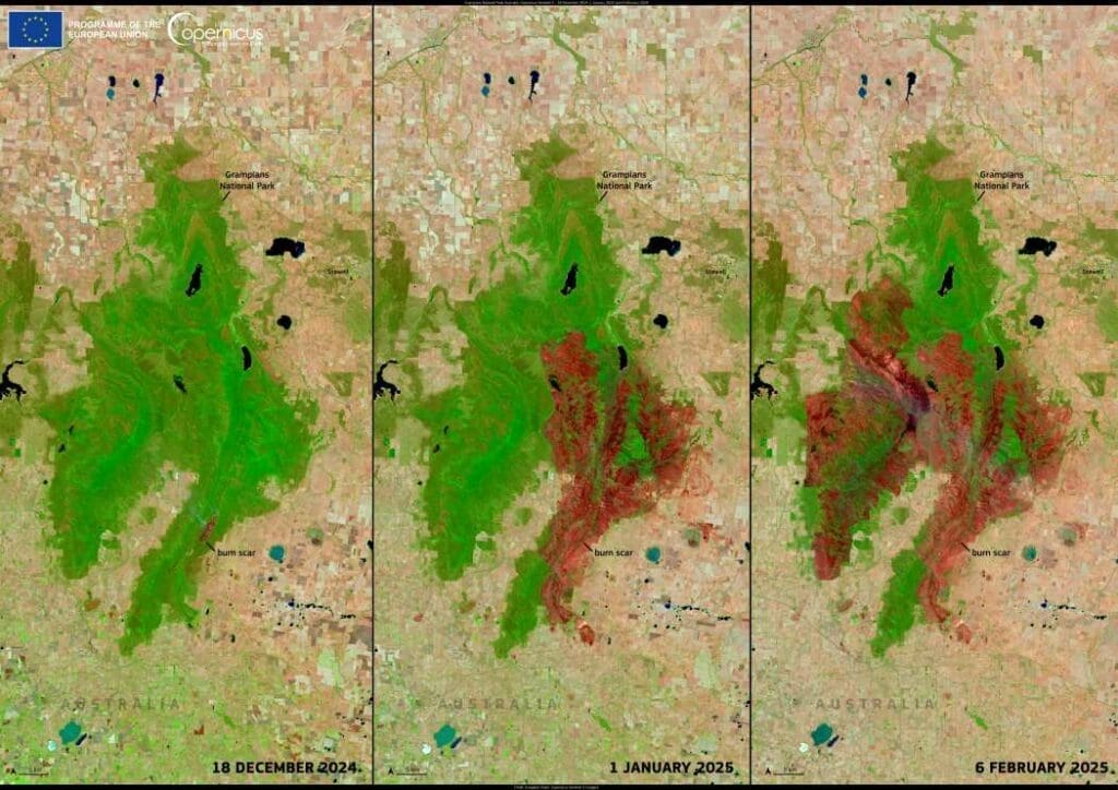
Grampians National Park, a renowned nature reserve in Victoria, Australia, has been ravaged by a series of bushfires since December 2024, leaving widespread destruction in…
Image of the day: January 2025 sets new global warmth recordNews Muser NewsDeskFebruary 9, 2025
Full article
Image of the day: January 2025 sets new global warmth record
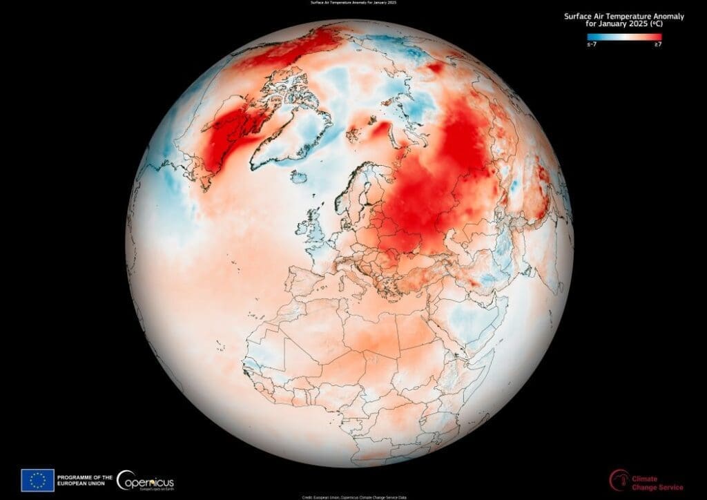
January 2025 has been confirmed as the warmest January ever recorded, underscoring the ongoing shift in global climate patterns. Data from the Copernicus Climate Change…
Image of the day: A shared cultural capital on the Italy-Slovenia borderNews Muser NewsDeskFebruary 8, 2025
Full article
Image of the day: A shared cultural capital on the Italy-Slovenia border
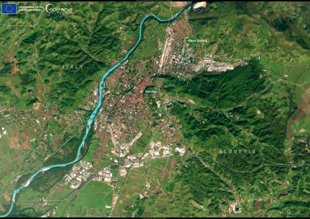
For nearly four decades, the European Capitals of Culture program has showcased the richness of European heritage, highlighting cities that use culture to shape their…
Image of the day: Historic flooding engulfs western FranceNews Muser NewsDeskFebruary 7, 2025
Full article
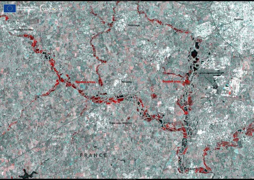
Image of the day: Historic flooding engulfs western France
Starting on 27 January 2025, a relentless series of storms brought extreme rainfall to western France, leading to the worst flooding in decades across Ille-et-Vilaine…
Image of the day: Cyclades Islands hit by seismic swarmNews Muser NewsDeskFebruary 6, 2025
Full article
Image of the day: Cyclades Islands hit by seismic swarm
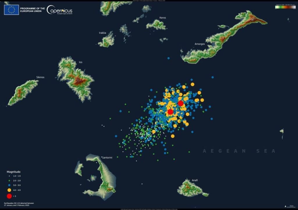
A surge of undersea earthquakes has been shaking Greece’s Cyclades Islands since January 27, 2025, with more than 1,000 tremors recorded so far. Several quakes…
Image of the day: Snow in Sierra Nevada, SpainNews Muser NewsDeskFebruary 5, 2025
Full article
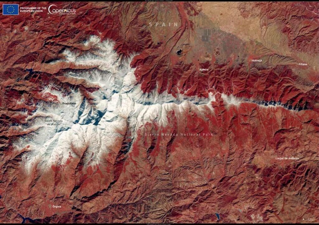
Image of the day: Snow in Sierra Nevada, Spain
On 2 February 2025, Spanish authorities issued a yellow warning for precipitation ahead of snowfall that affected the Sierra Nevada region on 3 February. The…
Image of the day: Saharan dust over the MediterraneanNews Muser NewsDeskFebruary 4, 2025
Full article
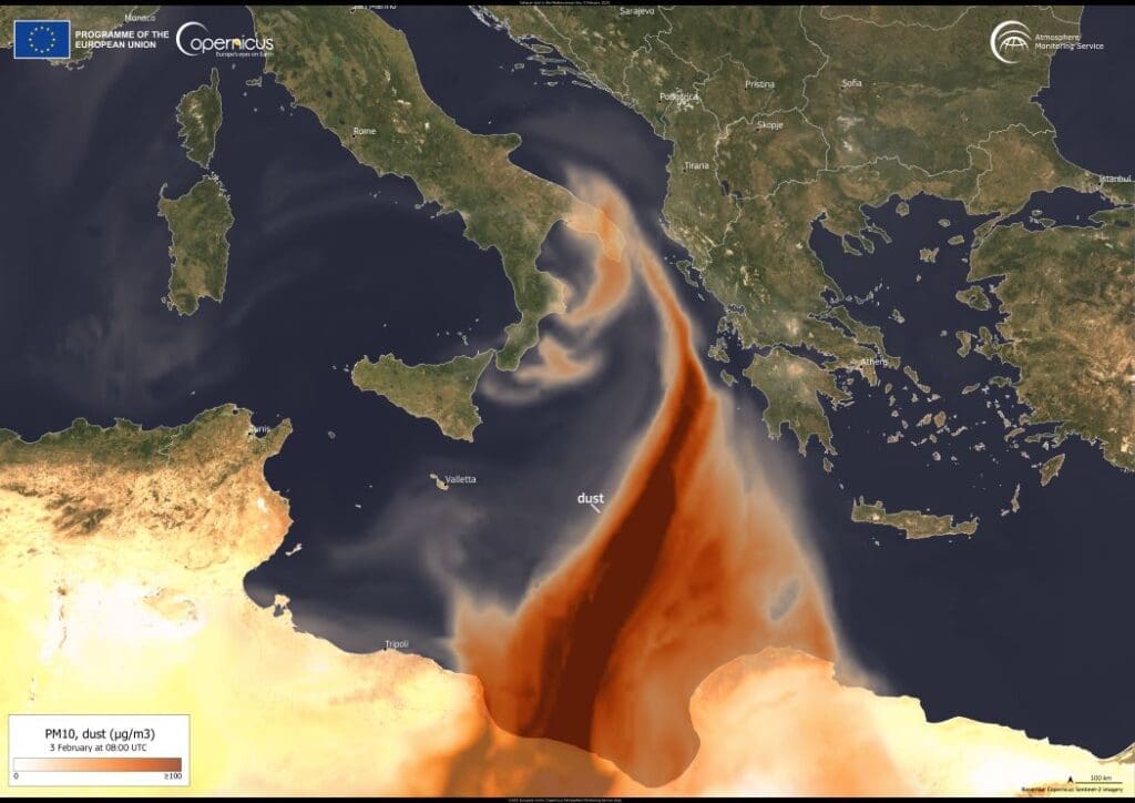
Image of the day: Saharan dust over the Mediterranean
On 2 February 2025, strong winds carried a vast cloud of Saharan dust across the Mediterranean, reaching southern Italy. The phenomenon, driven by a cyclone…
Image of the day: Wildfire in Nahuel Huapi National ParkNews Muser NewsDeskFebruary 3, 2025
Full article
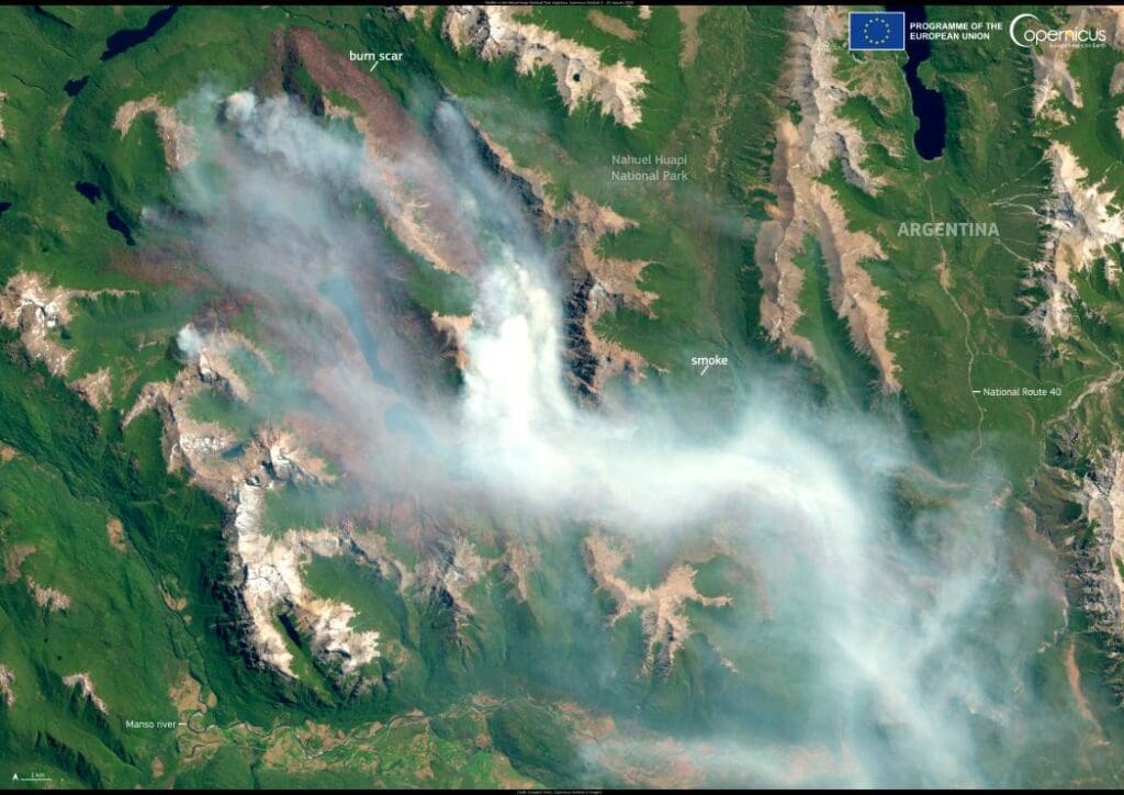
Image of the day: Wildfire in Nahuel Huapi National Park
A wildfire that ignited on December 25, 2024, in Argentina’s Nahuel Huapi National Park has burned over 6,900 hectares of land. The fire, sparked by…
Greenland’s ice is cracking faster as climate change accelerates glacier flowClimate Muser NewsDeskFebruary 3, 2025
Full article
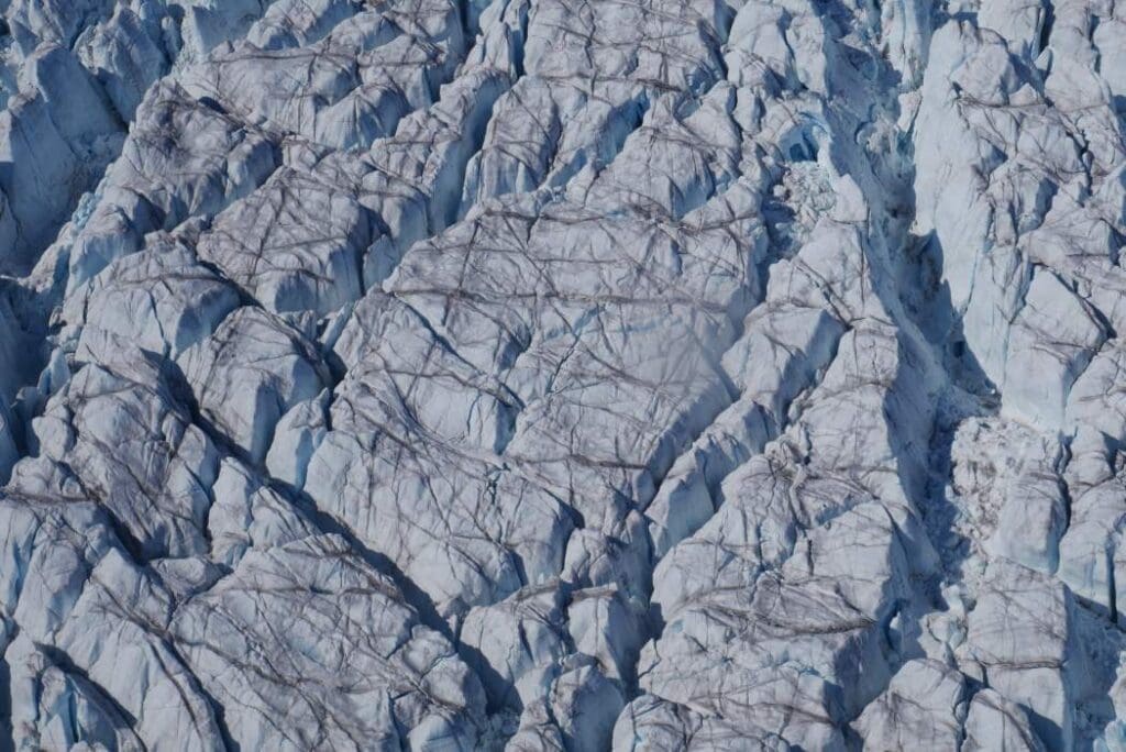
Greenland’s ice is cracking faster as climate change accelerates glacier flow
Summary The Greenland Ice Sheet is cracking open more rapidly as it responds to climate changeSea level riseBigger and deeper crevasses Summary: Greenland’s glaciers are…
Image of the day: Secoveljske soline wetlandsNews Muser NewsDeskFebruary 2, 2025
Full article
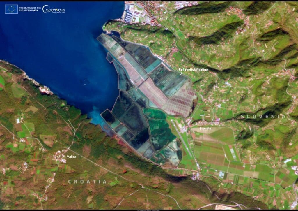
Image of the day: Secoveljske soline wetlands
Each year on 2 February, World Wetlands Day highlights the crucial role of wetlands in preserving biodiversity and maintaining environmental health. One of these vital…
Image of the day: Sørvágsvatn LakeNews Muser NewsDeskFebruary 1, 2025
Full article
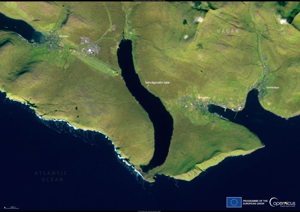
Image of the day: Sørvágsvatn Lake
Sørvágsvatn, the largest lake in the Faroe Islands, is captured in this Copernicus Sentinel-2 image from September 4, 2024. Located on the island of Vágar,…
Image of the day: Niagara Falls partially frozen in Arctic blastNews Muser NewsDeskJanuary 31, 2025
Full article
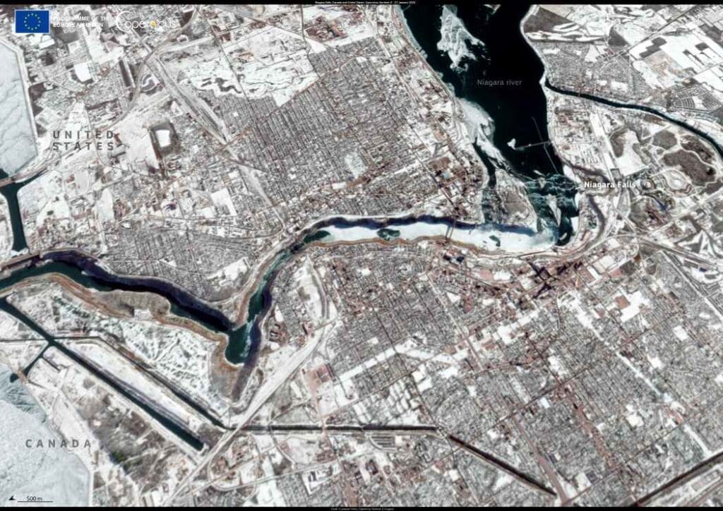
Image of the day: Niagara Falls partially frozen in Arctic blast
A striking Copernicus Sentinel-2 image taken on 27 January 2025 captures the partially frozen Niagara Falls after an Arctic air mass swept through the region.…
Image of the day: Haze blankets the Indo-Gangetic PlainNews Muser NewsDeskJanuary 30, 2025
Full article
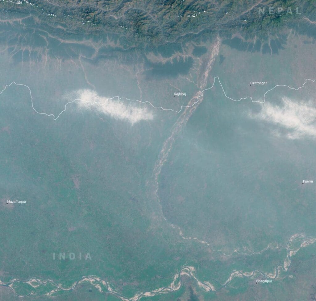
Image of the day: Haze blankets the Indo-Gangetic Plain
Summary: A region vulnerable to pollutionHealth risks and air quality monitoring Summary: A dense haze settled over parts of the Indo-Gangetic Plain in late January,…
Image of the day: Storm Herminia, FranceNews Muser NewsDeskJanuary 29, 2025
Full article
Image of the day: Storm Herminia, France
Storm Herminia brought devastating floods to western France on January 27, 2025, as heavy rainfall and strong winds battered the regions of Normandy and Brittany.…
Image of the day: Alaska’s shrinking snowfall captured from spaceNews Muser NewsDeskJanuary 28, 2025
Full article
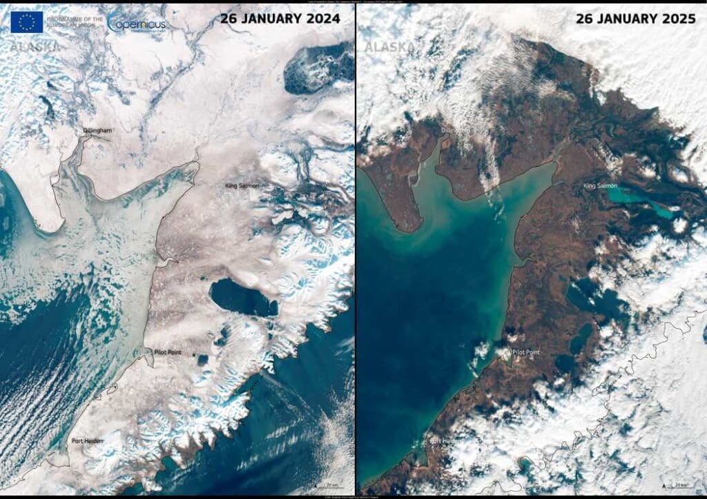
Image of the day: Alaska’s shrinking snowfall captured from space
Since December 2024, Alaska has experienced warmer-than-average temperatures, disrupting seasonal snowfall patterns. On January 15, 2025, Anchorage recorded an average temperature of −6.4°C, 2.4°C higher…
Image of the day: Atlantic winds as Storm Éowyn lashes IrelandNews Muser NewsDeskJanuary 27, 2025
Full article
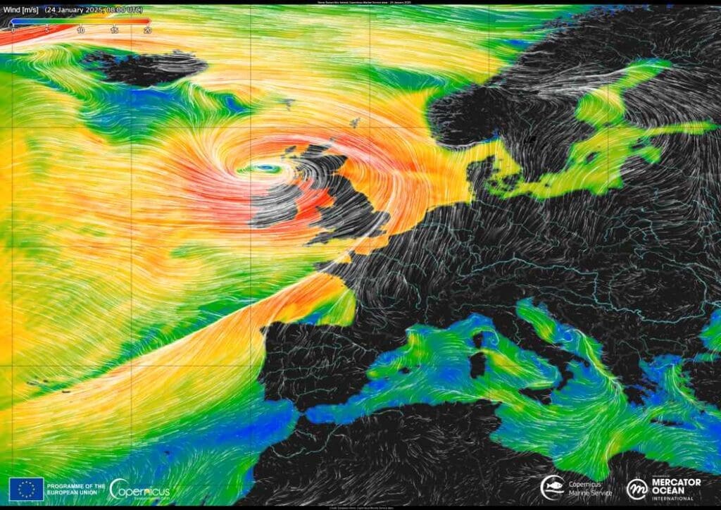
Image of the day: Atlantic winds as Storm Éowyn lashes Ireland
On 24 January 2025, Storm Éowyn struck Ireland, marking one of the most severe storms to hit the region in recent years. With winds exceeding…
Image of the day: Germany’s renewable energy revolutionNews Muser NewsDeskJanuary 26, 2025
Full article
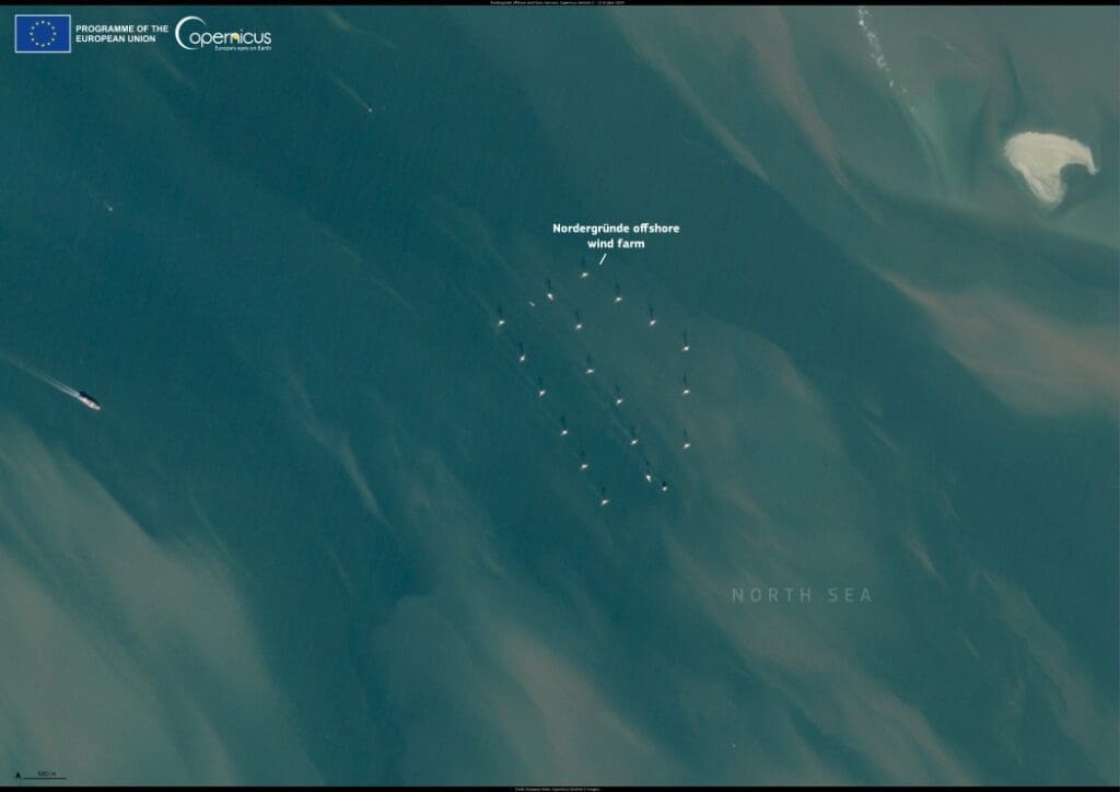
Image of the day: Germany’s renewable energy revolution
In a historic achievement for Germany, renewable energy sources made up 59% of the country’s electricity generation in 2024, marking a steady rise from 56%…
Image of the day: Malta’s commitment to bird conservationNews Muser NewsDeskJanuary 25, 2025
Full article
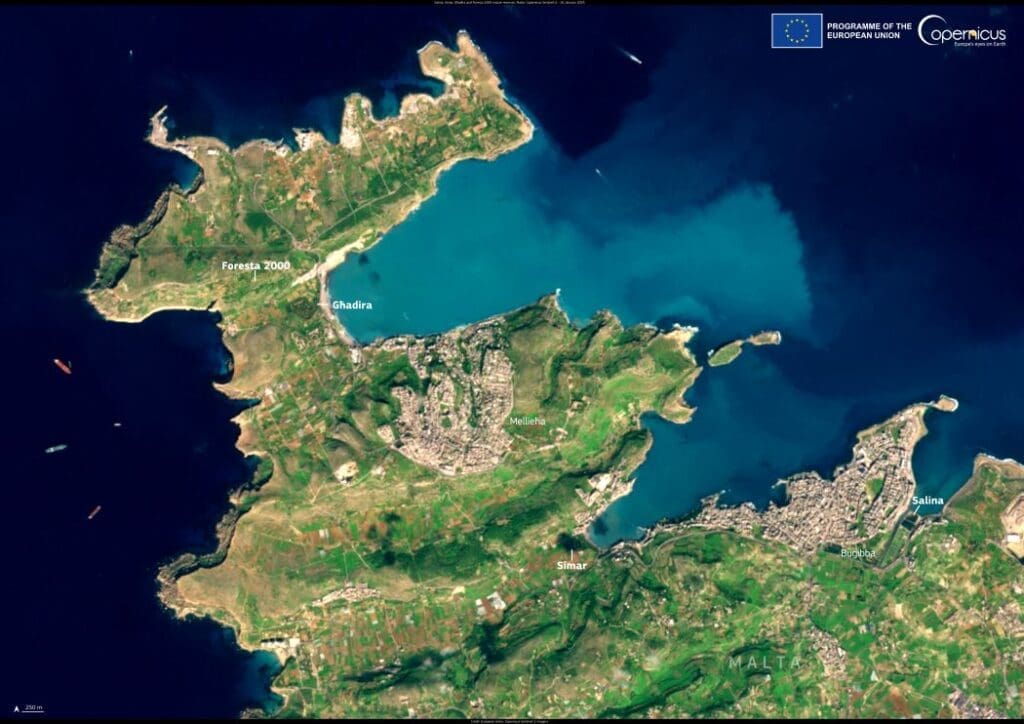
Image of the day: Malta’s commitment to bird conservation
Malta, the smallest member state of the European Union, stands as a beacon of biodiversity in the Mediterranean. Despite its limited surface area and population,…
Image of the day: Cyprus transforms its infrastructure for growthNews Muser NewsDeskJanuary 24, 2025
Full article
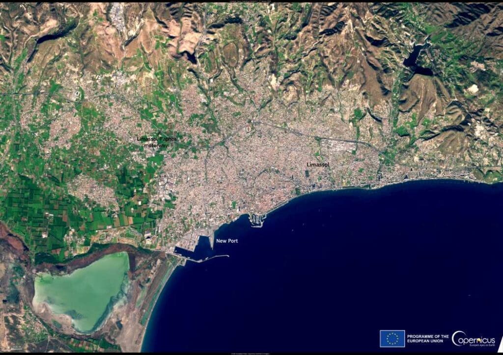
Image of the day: Cyprus transforms its infrastructure for growth
Cyprus A picturesque Mediterranean island celebrated for its history and strategic importance, is undergoing significant infrastructure upgrades to foster economic growth and connectivity. Known as…
Image of the day: Lava fountains light up Kilauea volcano in HawaiiNews Muser NewsDeskJanuary 23, 2025
Full article
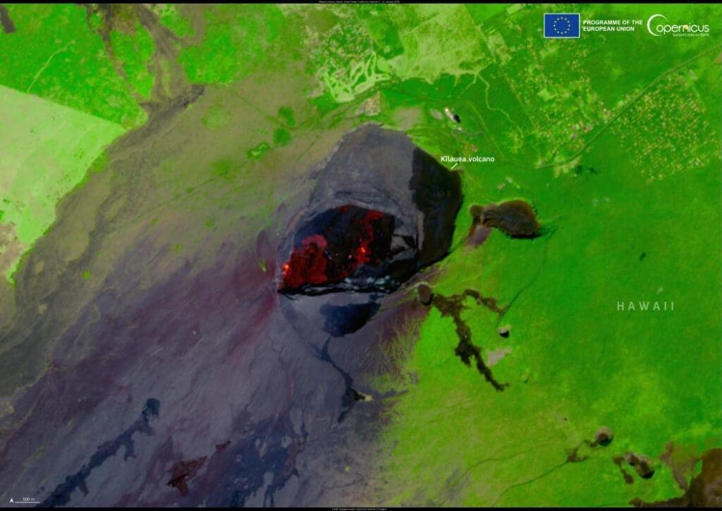
Image of the day: Lava fountains light up Kilauea volcano in Hawaii
Between January 15 and 18, 2025, Hawaii's Kīlauea volcano entered a new eruptive phase, marking the fourth eruption since December 23, 2024. This renewed activity…
Image of the day: Snowfall in the Atlas MountainsNews Muser NewsDeskJanuary 22, 2025
Full article
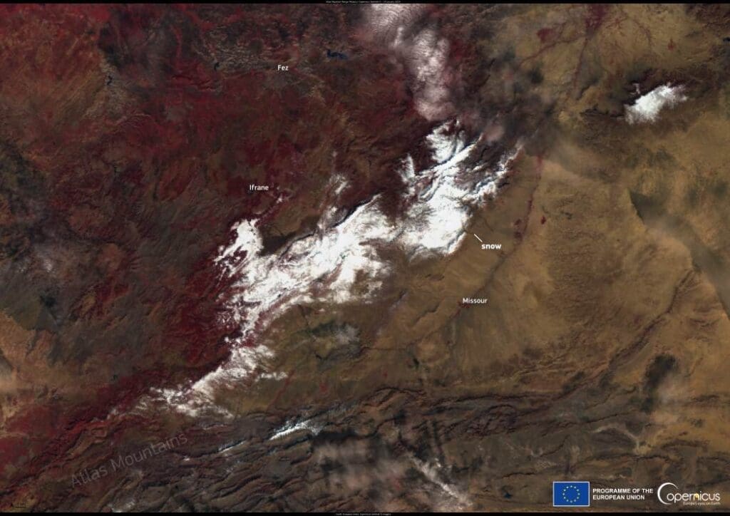
Image of the day: Snowfall in the Atlas Mountains
Snowfall blanketed Morocco’s mountainous regions above 1,400 meters between January 17 and 18, 2025, creating stunning winter vistas. In Ifrane, known as the Switzerland of…
Climate Science Digest: January 21, 2025Science Muser NewsDeskJanuary 22, 2025
Full article
Climate Science Digest: January 21, 2025
Explore the latest insights from top science journals in the Muser Press daily roundup, featuring impactful research on climate change challenges. Researchers create AI tool…
Image of the day: Tropical Cyclone SeanNews Muser NewsDeskJanuary 21, 2025
Full article
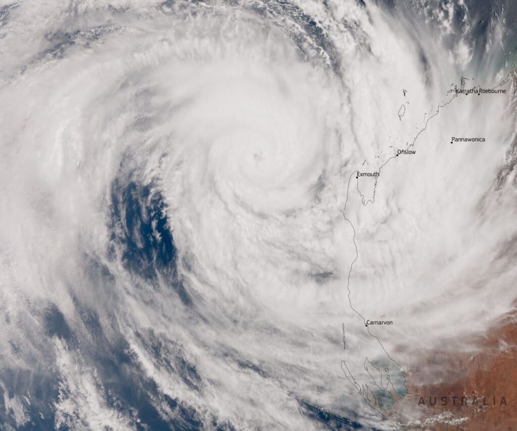
Image of the day: Tropical Cyclone Sean
On January 20, 2025, the Australian Bureau of Meteorology upgraded Tropical Cyclone Sean to a Category 4 storm as it churned off the coast of…
Image of the day: Singapore’s healing gardensNews Muser NewsDeskJanuary 20, 2025
Full article
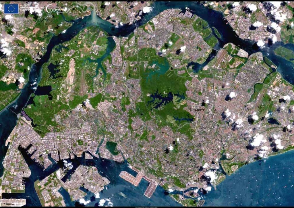
Image of the day: Singapore’s healing gardens
Singapore, renowned for its visionary urban planning and abundant green spaces, is charting a new course in mental health tourism with its therapeutic gardens. These…

