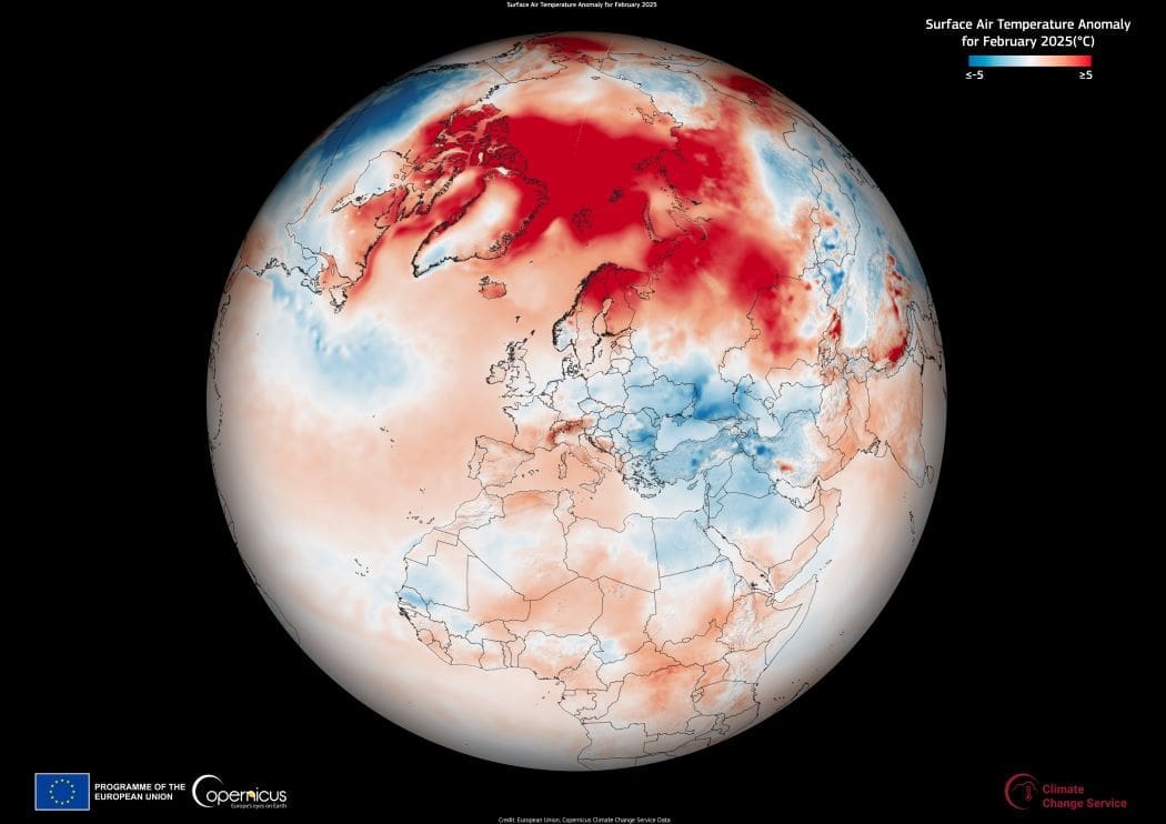
The Copernicus Climate Change Service (C3S) reports that February 2025 was the third warmest February recorded globally, with an average surface air temperature of 13.36°C. This was 0.63°C above the 1991–2020 average and 1.59°C higher than pre-industrial levels. The month also continued a pattern of record-breaking warmth, marking the 19th time in the last 20 months that global temperatures exceeded the 1.5°C threshold above pre-industrial levels.
While Europe’s land temperatures for February 2025 were only modestly above average at 0.44°C (0.40°C above the 1991–2020 norm), other parts of the world experienced significant temperature anomalies. Warming was particularly pronounced in the Arctic, including over Greenland, Svalbard (Norway), and parts of Canada. The average sea surface temperature for 60°S–60°N was 20.88°C, making it the second-highest February value on record, trailing only February 2024.

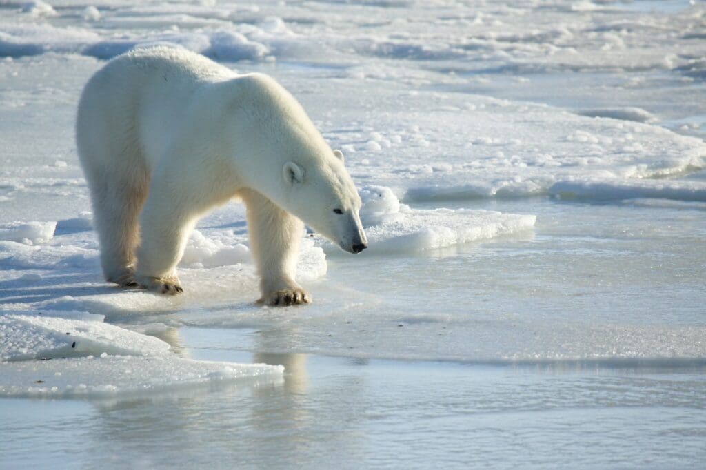
Arctic sea ice extent reached a record low for February, at 8% below the 1991–2020 average. This marks the third consecutive month of record-low Arctic sea ice extent, following record lows in December and January. The February 2025 extent of 13.7 million km² was 0.8 million km² below average and lower than the previous record minimum for the month, set in 2018. Although this is not an all-time low, it continues a concerning trend as Arctic sea ice approaches its typical maximum in March.
In the Southern Hemisphere, Antarctic sea ice also remained well below average. February is the month when Antarctic sea ice reaches its annual minimum, and in 2025, it was 2.5 million km² — 26% below the 1991–2020 average. While not the lowest February extent on record, this continues a trend of significantly reduced Antarctic sea ice observed since 2017.
Europe saw predominantly below-average precipitation in February 2025, particularly in central and eastern Europe, southeastern Spain, and Türkiye, where drought alerts remained in effect. These regions also experienced below-average surface soil moisture. In contrast, parts of the UK, France, and northwestern Russia retained moisture from a wetter-than-average January.
This C3S data visualization highlights the continued warming trend and its impacts across Europe and beyond. C3S provides open-access climate data, offering essential insights for tracking global climate patterns and informing climate strategies.
Featured image credit: European Union, Copernicus Climate Change Service Data