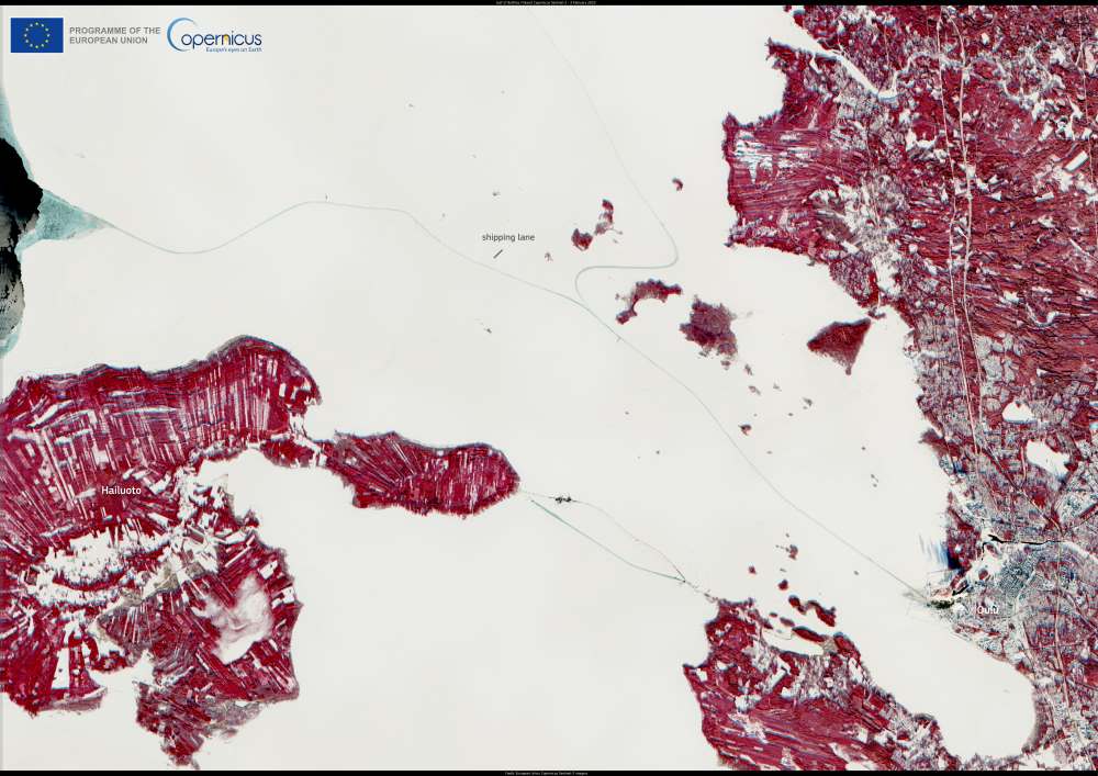
This image, captured by one of the Copernicus Sentinel-2 satellites on 3 February 2025, shows shipping lanes cutting through the icy waters of the Gulf of Bothnia in the Baltic Sea, near Hailuoto, Finland.
Winter navigation in the region is challenging due to extensive sea ice, which can persist for an average of six months each year. Icebreakers play a crucial role in maintaining access to ports, ensuring that maritime transport continues despite the harsh conditions.

In the middle of the image, shipping lanes appear as dark, ice-free channels contrasting with the surrounding frozen waters. These routes are kept open by icebreakers, which clear paths for vessels navigating through the gulf.
Copernicus satellites provide continuous monitoring of Arctic and sub-Arctic regions, delivering essential data on sea ice coverage, environmental changes, and shipping conditions. The Copernicus Arctic Hub compiles this information, supporting decision-making and sustainable management of the region by offering insights into ice dynamics, climate trends, and maritime operations.
Featured image credit: European Union, Copernicus Sentinel-2 imagery


