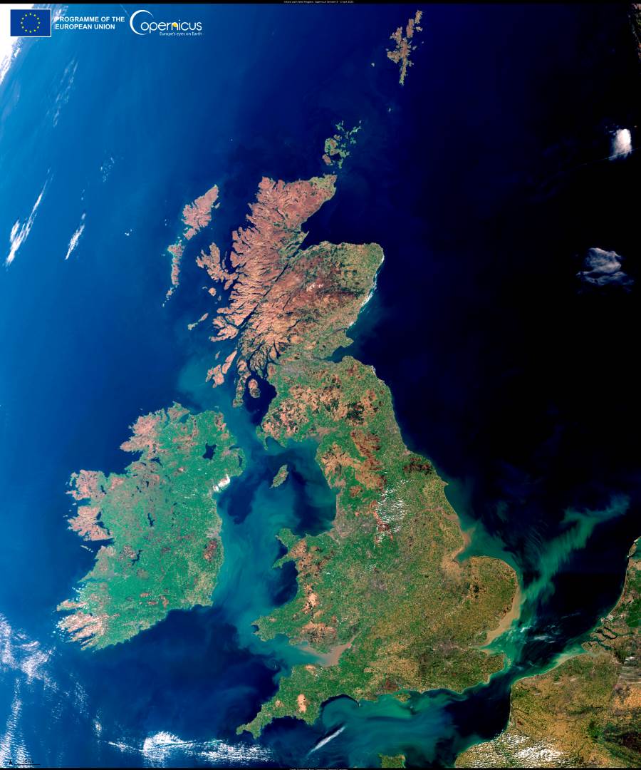
Following the UK’s sunniest March since records began in 1910, skies cleared dramatically over the British Isles, offering an unusually crisp satellite view captured on 2 April 2025. This Copernicus Sentinel-3 image reveals the full breadth of the archipelago, with cloud-free visibility stretching from the green lowlands of Ireland and southern England to the snow-flecked Scottish Highlands.
The cloudless skies reflect a period of prolonged sunshine and exceptionally dry conditions that have drawn attention from meteorologists and climate observers. According to the Met Office, the UK experienced record-breaking sunshine hours during March, with parts of England and Wales receiving less than half their usual rainfall.

In the image, sediment flows are also visible along the coasts, particularly in estuarine areas where freshwater meets the sea — patterns that help scientists monitor land runoff, water quality, and ecosystem changes.
Copernicus satellite data plays a key role in tracking the broader environmental implications of such dry spells, helping assess how vegetation, soil moisture, and water supplies are affected. This type of monitoring supports research into climate patterns and informs long-term land management across Europe and beyond.
Featured image credit: European Union, Copernicus Sentinel-3 imagery