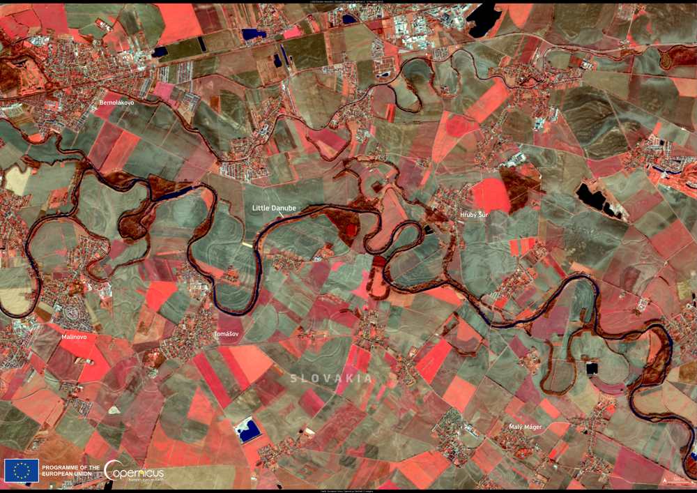
This false-color Copernicus Sentinel-2 image, captured on 5 February 2025, reveals the winding course of the Little Danube in Slovakia. A tributary of the Danube River, the 126.6 km-long Little Danube branches off near Bratislava and weaves through a patchwork of agricultural fields and small towns before merging with the Váh River in Kolárovo. The image highlights the river’s intricate network of meanders, which shape the surrounding landscape and sustain a rich ecosystem.
The Little Danube is the longest and largest left-bank branch of the Danube in Slovakia. As it flows southeast from its separation point near the Slovnaft refinery, it carves a natural channel 30 to 50 meters wide, flanked by lowland forests. Its watershed covers 3,173 km2, with an average flow rate recorded at 31,681 m3/s in Trstice (2008). Several tributaries, including Čierna voda, Blatina, and Klátovské rameno, feed into the river, enhancing its hydrological complexity.

This river plays a crucial role in the formation of the inland delta of the Danube, along with the Mosoni-Duna in Hungary. The alluvial deposits laid down during the Quaternary period created a dynamic floodplain environment, which has since been shaped by both natural forces and human activity.
Žitný ostrov (Rye Island), the largest river island in Europe, borders the Little Danube and serves as a significant freshwater resource. While water quality has improved significantly since the 1970s, pollution hotspots still exist near developed areas, where elevated sulphate, chloride, and nitrate levels are monitored.
Beyond its ecological value, the Little Danube is also a historical and cultural landmark. It is home to some of Europe’s last preserved water-powered mills, such as the historic watermills in Dunajský Klátov and Jelka, which now serve as museums. These sites offer a glimpse into the region’s traditional milling practices and are popular destinations for visitors.
Data from the Copernicus Sentinel satellites provides crucial insights into the management of river systems like the Little Danube, supporting conservation efforts and sustainable water use in the region.
Featured image credit: European Union, Copernicus Sentinel-2 imagery


