This image, captured by one of the Copernicus Sentinel-2 satellites on 3 February 2025, shows shipping lanes cutting through the icy waters of the Gulf of Bothnia in the Baltic Sea, near Hailuoto, Finland.

Winter navigation in the region is challenging due to extensive sea ice, which can persist for an average of six months each year. Icebreakers play a crucial role in maintaining access to ports, ensuring that maritime transport continues despite the harsh conditions.
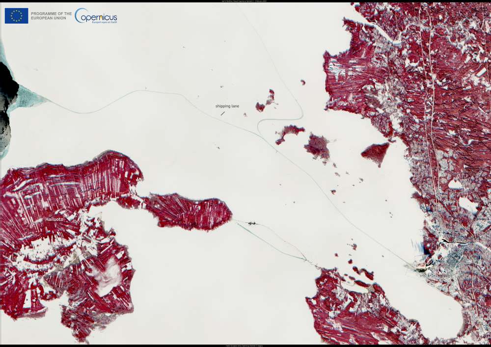
Satellite image: Gulf of Bothnia, Finland (s. icy waters)
Gulf of Bothnia. Credit: European Union, Copernicus Sentinel-2 imagery

In the middle of the image, shipping lanes appear as dark, ice-free channels contrasting with the surrounding frozen waters. These routes are kept open by icebreakers, which clear paths for vessels navigating through the gulf.

Copernicus satellites provide continuous monitoring of Arctic and sub-Arctic regions, delivering essential data on sea ice coverage, environmental changes, and shipping conditions. The Copernicus Arctic Hub compiles this information, supporting decision-making and sustainable management of the region by offering insights into ice dynamics, climate trends, and maritime operations.

Featured image credit: European Union, Copernicus Sentinel-2 imagery

Marine heatwaves devastate red gorgonians in the Medes IslandsScience

Marine heatwaves devastate red gorgonians in the Medes Islands

By University of Barcelona The increase in the frequency and intensity of marine heatwaves in recent decades is one of the effects of global climate…
SourceSourceJune 14, 2024 Full article
Rapid urbanization in Africa transforms local food systems and threatens biodiversityScience

Rapid urbanization in Africa transforms local food systems and threatens biodiversity

By Bettina Greenwell, International Institute for Applied Systems Analysis (IIASA ) Urbanization in Africa is accelerating quickly, showing no signs of slowing down. An international…
SourceSourceMay 31, 2024 Full article
A rocky landscape with tundra plants near the eastern coast of Greenland, similiar to what the interior of the island may have looked like when its massive ice sheet melted away
Greenland fossil discovery reveals increased risk of sea-level catastropheNewsScience

Greenland fossil discovery reveals increased risk of sea-level catastrophe

Seeds, twigs and insect parts in ice core stun scientists and confirm that center of ice sheet melted in recent past. By Joshua Brown |…
SourceSourceAugust 6, 2024 Full article