Panevėžys, a key industrial and cultural center in northern Lithuania, stands at the crossroads of major European transport routes. The city is known for its strong manufacturing sector, a thriving business community, and a well-balanced urban environment. It is strategically positioned along the Via Baltica highway and the future Rail Baltica corridor, linking it to major cities like Vilnius, Riga, and beyond.

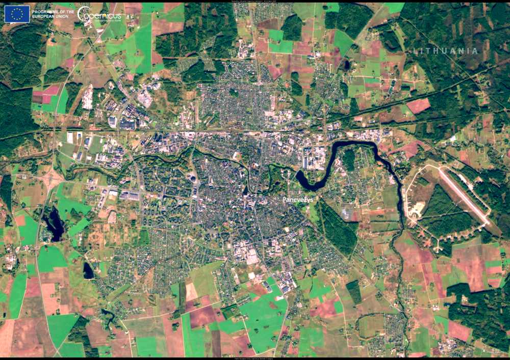
This Copernicus Sentinel-2 image, captured on 20 October 2024, provides a striking view of the city’s compact urban landscape, shaped by the Nevėžis River.
Beyond its industrial and economic strengths, Panevėžys is a clean and green city, offering high quality of life to its 90,000 residents. Senvagė, the Old River Bed of the Nevėžis, is a focal point for local festivals and leisure activities, reinforcing the city’s role as a cultural and recreational hub in the Aukštaitija region. The city also takes pride in its vibrant cultural scene, with institutions such as the J. Miltinis Drama Theatre, Stasys Museum, and the Puppet Wagon Theatre.
Copernicus Sentinel satellite data supports urban planning and environmental management, helping cities like Panevėžys enhance sustainability and smart city development.
Featured image credit: European Union, Copernicus Sentinel-2 imagery


