Baie de Goulven, nestled along the Brittany coast of France, is a remarkable example of harmony between natural forces and human stewardship. This diverse landscape features mudflats, estuaries, salt marshes, shingle and sandy beaches, rocky islets, coastal dunes, and marine cliffs. These interconnected habitats form a 180-hectare sanctuary, vital for both flora and fauna.
The bay is an essential haven for birdlife, with over 20,000 waterbirds visiting annually during migration and winter. Species such as Charadrius hiaticula (ringed plovers), Vanellus vanellus (lapwings), and Calidris alpina (dunlins) thrive here, with thousands seen during passage and wintering seasons.
Gulls, geese, ducks, avocets, egrets, and spoonbills are among the other frequent visitors, while smaller waders find safe havens in the bay’s grasses and rocky islets. Some species even nest in the dunes and beach areas during spring, adding to the bay’s ornithological significance.

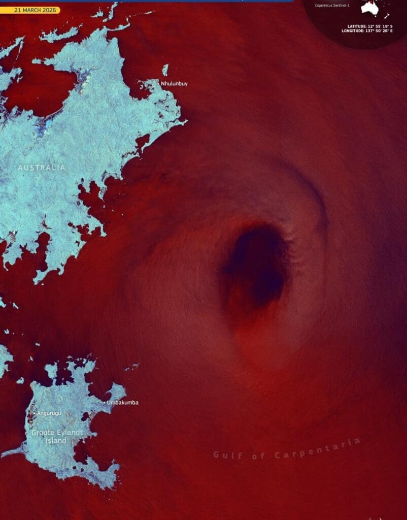
This Copernicus Sentinel-2 image, captured on 5 October 2024, showcases the bay’s intricate ecosystems.
Beyond its avian inhabitants, the bay hosts an astonishing botanical diversity, with nearly 600 plant species contributing to its rich ecological tapestry. The landscape is shaped by a delicate balance of natural and human influences, including a dike constructed in 1823 by Louis Rousseau. The result is an intricate mosaic of marine and coastal environments, complemented by brackish and freshwater marshes.
Recognized as an important ornithological reserve and designated as a Natura 2000 site, Baie de Goulven is a testament to the resilience and biodiversity of well-protected ecosystems. Its continued preservation ensures a safe haven for countless species while offering an inspiring glimpse into the interconnectedness of nature.
Featured image credit: European Union, Copernicus Sentinel-2 imagery