On 10 January 2025, Paraguay declared a 60-day national emergency as rampant forest fires swept across the nation, severely impacting protected areas, biodiversity, and local communities. To date, approximately 15,000 hectares have been affected, predominantly in the eastern regions.
Authorities have recorded over 2,200 heat sources and 218 active fires, surpassing the historical averages of the past seven years.
Among the affected areas is Ypoá National Park, a vital ecological zone spanning 100,000 hectares across the Paraguarí, Ñeembucú, and Central departments. Established in 1992, the park is renowned for its extensive shallow lakes, floating vegetation mats, forested islands, savannahs, and streams. This diverse habitat supports numerous threatened species and serves as a crucial stopover for migratory birds.

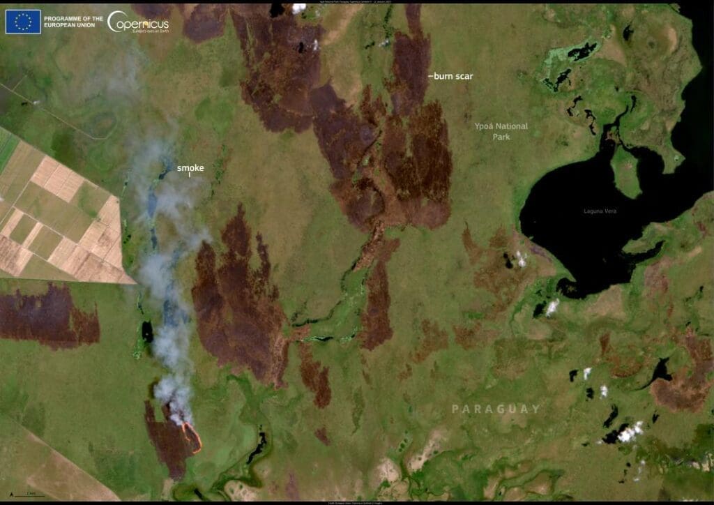
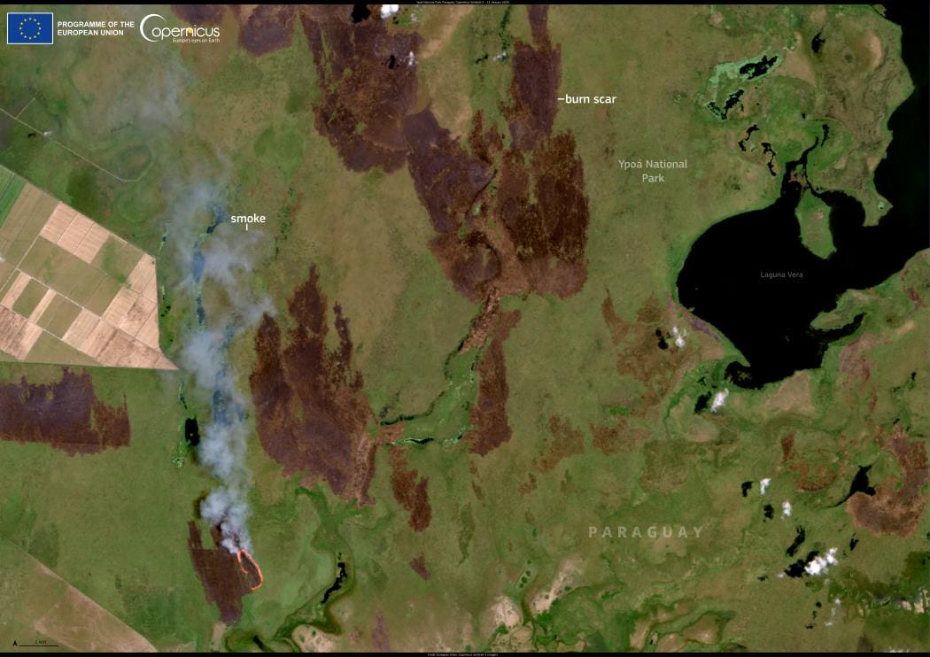
The accompanying Copernicus Sentinel-2 satellite image, acquired on 12 January 2025, starkly illustrates the extent of the wildfires within Ypoá National Park.
Open-access data from the Copernicus Sentinel satellites are indispensable for monitoring global wildfires, enabling authorities and conservationists to assess the damage and coordinate responses to safeguard affected ecosystems and communities.
Featured image credit: European Union, Copernicus Sentinel-2 imagery


