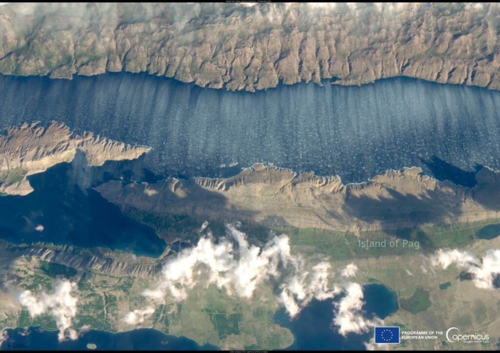
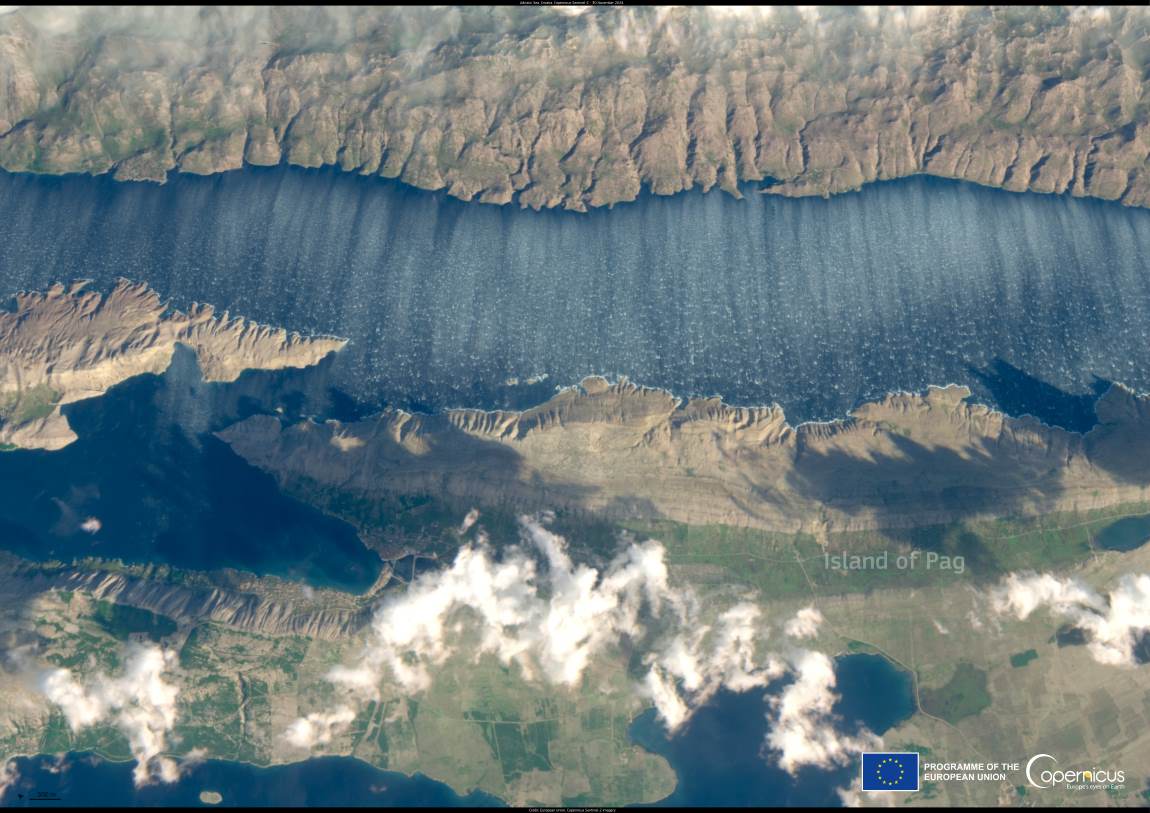
The captivating image captured by the Copernicus Sentinel-2 satellite reveals the striking effects of the bora wind over the Adriatic Sea, specifically between Croatia’s Dalmatian coast and the island of Pag. This natural phenomenon, marked by its dynamic interaction between wind and water, offers a vivid example of how regional weather conditions shape the marine environment.
On the day the satellite acquired the image, the bora wind was in full force, reaching speeds exceeding 100 km/h. This powerful katabatic wind originates from the land, accelerating as it descends through the mountainous terrain lining Croatia’s coastline. Upon reaching the sea, the bora’s intense force creates short, choppy waves that break into distinctive white foam, visible even from space.

The parallel streaks depicted on the sea surface result from the bora’s interaction with the water. These linear patterns, aligned with the wind’s direction, form as the wind stretches and disturbs the sea surface. The shallow and narrow waters of the Adriatic amplify the bora’s impact, causing the waves to foam more readily. This combination of topography, wind speed, and sea conditions makes the Adriatic particularly susceptible to such dramatic displays.
Beyond their aesthetic appeal, bora winds can pose significant challenges for navigation. The sudden and intense gusts can make sailing and shipping hazardous, especially in regions where these winds are both frequent and forceful. To mitigate these risks, the Copernicus Marine Service provides vital support by offering high-resolution ocean data. This includes detailed forecasts of winds, waves, and currents, enabling safer navigation and optimized route planning for vessels operating in the area.
Featured image: European Union, Copernicus Sentinel-2 imagery


