Brazil, the world’s leading exporter of soya and corn, endured a harrowing drought in 2024, leaving its vast agricultural sector grappling with one of the most severe water crises in the nation’s history. Among the hardest-hit areas was the Tapajós River, a crucial transportation route for grain exports from Mato Grosso, the epicenter of Brazil’s agricultural output.
In October, the Tapajós experienced unprecedented water level reductions, grounding barge traffic entirely as its riverbed revealed large expanses of exposed sand. The crisis disrupted supply chains, further stressing a region vital to global food security.

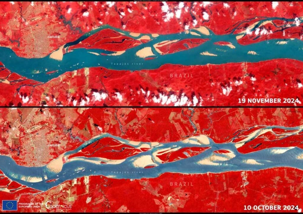
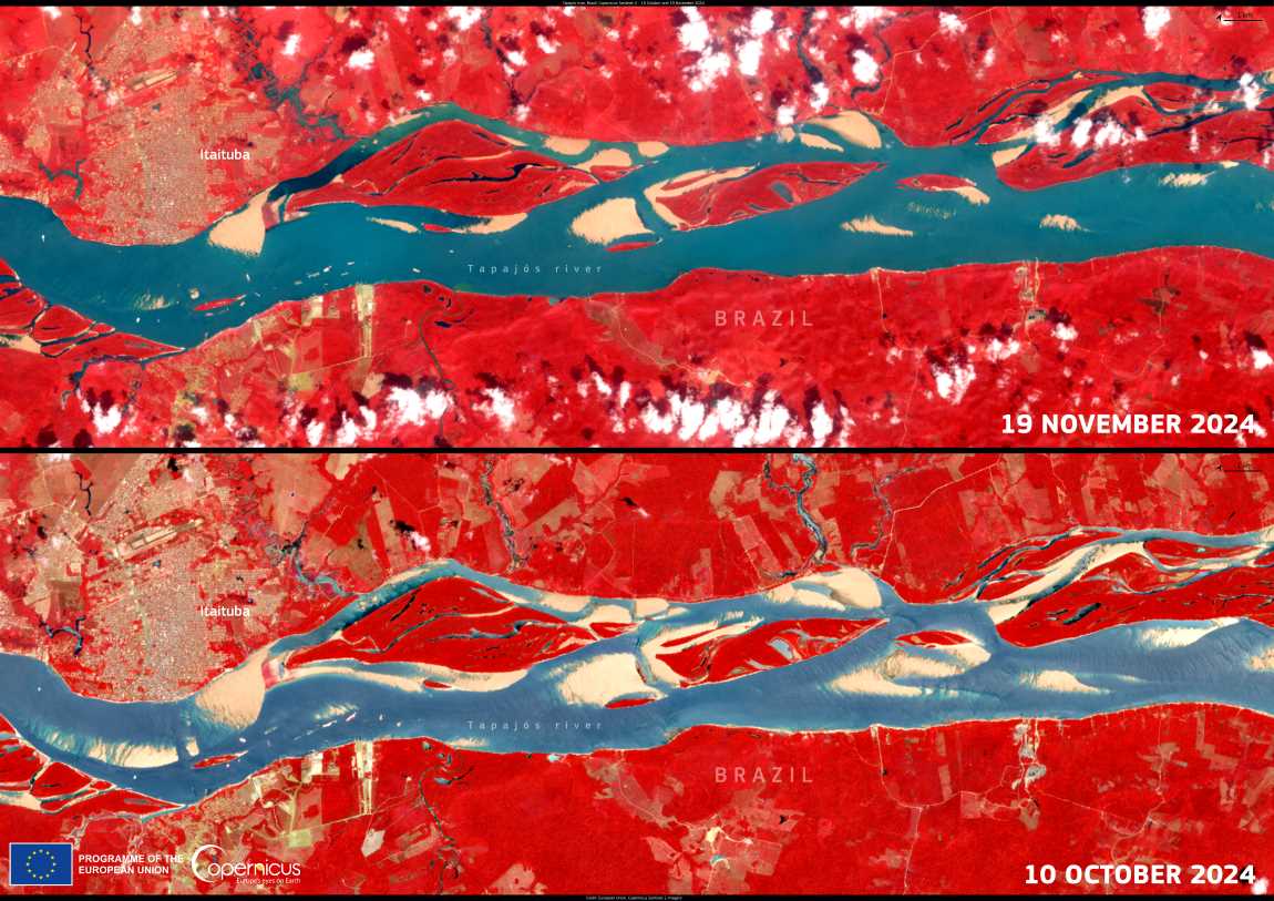
Satellite imagery from the Copernicus Sentinel-2 mission starkly highlighted the river’s plight. A photograph from October 10 vividly depicted the exposed riverbed and reduced flow, serving as a visual testament to the drought’s intensity.
The November rains offered a lifeline, partially reviving the Tapajós. A subsequent Sentinel-2 image captured on November 19 illustrated the river’s tentative recovery, with transport operations resuming at 50% of their usual capacity. Though a significant improvement, the partial restoration underscores the lingering challenges for water-dependent logistics and agriculture in the region.
This drought was not merely a local challenge but part of a global pattern of increasingly extreme weather events. The Copernicus Global Drought Observatory (GDO), a key tool in monitoring such crises, has provided vital data on drought conditions to guide resource management and emergency response efforts
Featured image credit: European Union, Copernicus Sentinel-2 imagery


