As urban areas expand rapidly around the world, the need for climate-conscious planning has never been greater.
New research suggests that optimizing city layouts to local climates and geography could significantly cut carbon dioxide (CO2) emissions. Yet, researchers warn that no universal solution exists, given the complexity and context-dependent nature of urban CO2 emissions.
With an estimated 2.5 billion additional people expected to live in cities by 2050, the findings spotlight the urgency of adapting urban planning to address climate impacts.
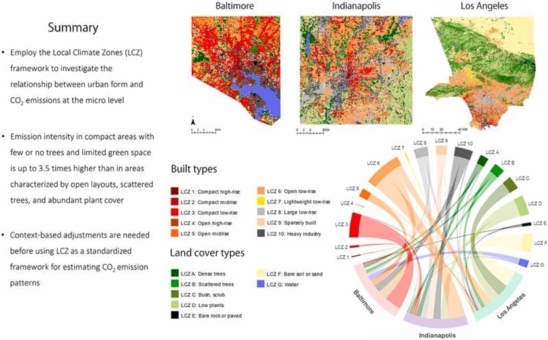
The study, published in Journal of Environmental Management, explores the role of “urban form” in reducing CO2 emissions across three U.S. cities with distinct climates and layouts: Baltimore, Indianapolis, and Los Angeles. This detailed examination, led by a team from Hiroshima University, Shiraz University, and Northern Arizona University, uses a sophisticated framework called Local Climate Zones (LCZ) to classify the cities’ varied built environments and analyze emissions.

Credit: Masoud Javadpoor, Ayyoob Sharifi, Kevin R. Gurney (2024) | DOI: 10.1016/j.jenvman.2024.122723 | Journal of Environmental Management
“The relationship between urban form and CO2 emissions is well recognized. However, most studies so far have been limited to examining the urban form at the macro level and there is a lack of granular understanding of this dynamic relationship,” said Ayyoob Sharifi, professor at the IDEC Institute, at Hiroshima University, and study co-author. “This study employs the Local Climate Zones framework to investigate the relationship between urban form and CO2 emissions at the micro level.”
The LCZ framework, originally designed to classify urban areas by characteristics like building height, density, and vegetation, offers a standardized method for analyzing how different types of urban spaces contribute to climate impacts.
Traditionally used to understand urban heat islands, this approach categorizes urban spaces into types – ten built zones (such as low-rise buildings, high-rise buildings, heavy industry) and seven natural zones. For the study, the researchers applied LCZ to assess urban areas using satellite imagery and remote sensing, allowing them to capture the details of Baltimore, Indianapolis, and Los Angeles in terms of their distinct climate and density.
Cities, climate, and carbon footprints: a tailored approach
The research team selected Baltimore, Indianapolis, and Los Angeles specifically for their contrasting climates and population densities. Los Angeles, for example, has a warm, dry climate with relatively stable temperatures, while Indianapolis experiences cold, humid conditions. Baltimore, by contrast, has a mixed, humid climate and a higher population density than either of the other two cities, although Los Angeles has a much larger geographic spread.
Using data from the Hestia Project, which tracks fossil-fuel CO2 emissions at granular street- and building-level scales, the study revealed new insights into how local urban designs affect emissions. Notably, the researchers found that while optimizing green and open spaces is essential for lowering CO2 output, the impact of any specific urban form is closely linked to the city’s unique environmental and social context.
“The results demonstrate that the relationship between urban form and CO2 emissions is complex and dynamic. Patterns could be different depending on the context and factors such as climatic conditions and size and function of the city. Patterns observed in a specific city cannot necessarily be generalized to other cities,” said Sharifi.
According to the study, focusing on compact, high-density developments is not enough without strategic planning of green and open spaces. “Without smart and adequate provision of open and green spaces, compact urban development will have limited capacity to mitigate urban CO2 emissions,” Sharifi added.
The researchers hope these findings will encourage cities to avoid blanket strategies that might ignore critical local variables like climate and population density. The study suggests that urban planners adopt nuanced, data-driven approaches when designing low-emission cities.
As Sharifi emphasized: “This means that one-size-fits-all approaches cannot be applied to determine optimized urban forms.”
The team plans to expand their research to additional cities worldwide, aiming to refine their understanding of LCZ and its role in shaping emissions under different climate and socioeconomic conditions.
“We aim to conduct more research involving data from a larger number of cities from different parts of the world to [better] understand… the association between LCZ type and CO2 emissions under different climatic and socioeconomic conditions,” said Sharifi.
With further exploration, the researchers hope to identify targeted ways for cities globally to reduce emissions through customized urban planning and design strategies.
Journal Reference:
Masoud Javadpoor, Ayyoob Sharifi, Kevin R. Gurney, ‘Mapping the relationship between urban form and CO2 emissions in three US cities using the Local Climate Zones (LCZ) framework‘, Journal of Environmental Management 370, 122723 (2024). DOI: 10.1016/j.jenvman.2024.122723
Article Source:
Press Release/Material by Hiroshima University
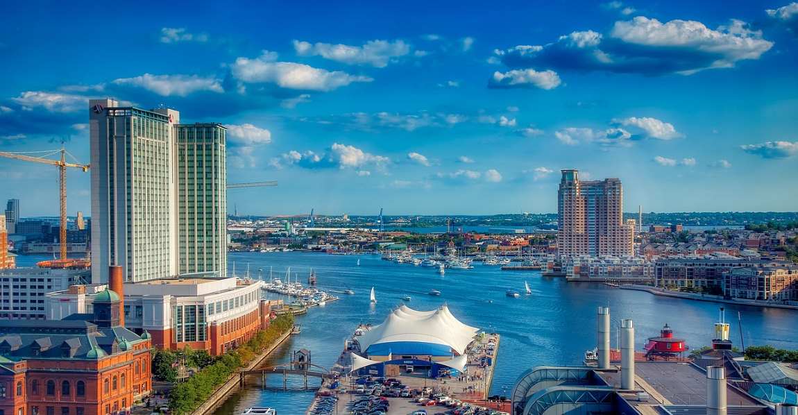
Featured image: Baltimore Harbor | Baltimore, Maryland, U.S.A. Credit: Pixabay


