As climate change intensifies extreme weather events, communities face increasing challenges in preparing for disasters.
A new guidance report, developed by scientists at the Desert Research Institute (DRI) and the U.S. Geological Survey (USGS), seeks to help emergency managers better incorporate climate data into their planning and exercises. This resource addresses the growing gap between past disaster experiences and future climate-driven events, providing a vital tool for emergency preparedness.
The report, funded by the California Department of Water Resources and available on DRI’s website, provides emergency planners with methodologies for integrating publicly available climate projections and historical weather data into disaster simulations. These simulations can enhance the effectiveness of emergency response by offering more precise predictions about the potential impact of storms, floods, droughts, and other extreme events.
The report is aimed at two key audiences: emergency management practitioners and data developers. For emergency planners, the guidance outlines the use of up-to-date climate data that reflects current scientific projections. Data developers will find techniques for constructing realistic disaster scenarios, ensuring that simulations are grounded in robust climate information.

Preparing for Future Risks
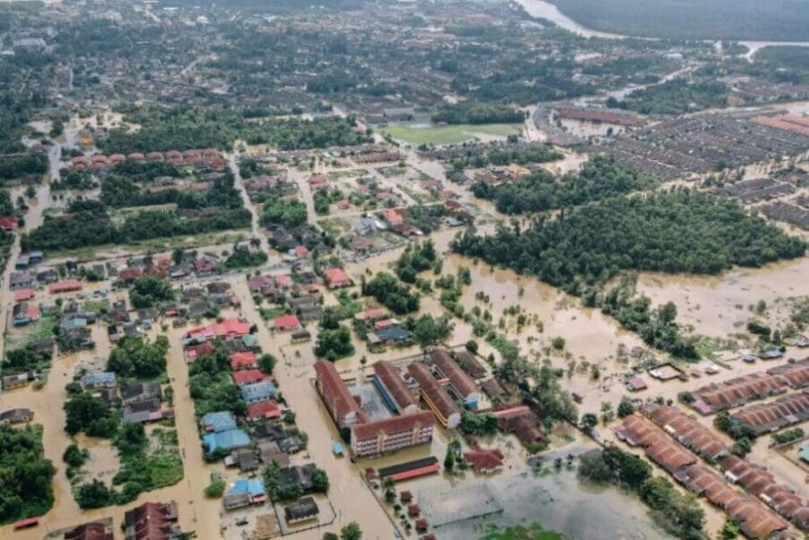
“Emergency response planners, critical infrastructure owners and operators, and natural resource managers in our region face impacts from increasingly frequent and severe atmospheric river (AR) storm events due to global warming,” explains Maureen McCarthy, a research professor at DRI and co-author of the report. “This primer provides a guide for emergency planners to develop scenarios that can test their ability to anticipate, respond, and recover from these events, and to inform actions for strengthening community resilience in the future.”
The report aims to inform emergency planners on how to strengthen community resilience by preparing for the worst-case scenarios these extreme events might bring.
Innovative climate data integration
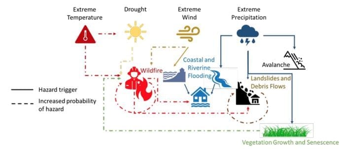
The report provides practical tools for using climate data in disaster planning. By creating computer simulations and visual maps, planners can better understand how future climate conditions may differ from past experiences. These tools can simulate variables like temperature, precipitation, and wind patterns, offering planners a clearer picture of how disasters may evolve.

“In many cases, emergency managers will use a historical storm for their exercise scenario and make it qualitatively more severe to address climate change, but we’re advocating for creating scenarios that are more quantitative so that maps, visuals, and data help people to conceptualize what might happen more vividly,” says Christine Albano, lead author and ecohydrologist at DRI. “We also propose methods for creating scenarios that represent our best knowledge of how storms or other hazards might be different from those we have seen before. The hope is that it spurs deeper conversations informed by data.”
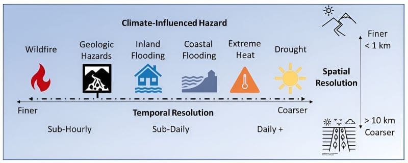
Albano adds that the guidance also provides methods for tailoring data to different disaster types. For instance, simulations of fast-moving events like wildfires or landslides may require minute-by-minute data over a small area, while drought planning might only need daily data but across a much larger region.
Lessons from Past Projects
The report builds on insights from previous projects such as Water for the Seasons, which focused on drought scenarios in the Truckee River Basin, and the ongoing ARkStorm@SierraFront Project, designed to help California and Nevada communities prepare for extreme AR events. Lessons from these projects, combined with feedback from over 300 emergency management professionals, were essential in shaping the guidance.
“Discussions with community members combined with the tabletop exercise provided insights about the effectiveness of federal, tribal, state, local and private sector emergency response plans to respond to an event of this scale and duration,” McCarthy notes. The hands-on discussions and tabletop exercises conducted during these projects highlighted the need for more climate-informed emergency response strategies.
Albano emphasizes that the integration of climate data into emergency planning has been a long-term effort. “The data and tools now available for understanding and visualizing future risks and hazards is pretty incredible,” she says. “The report offers an up-to-date list of these resources in the hope that they will be useful to emergency managers.”
More information: Christine Albano (DRI), Maureen McCarthy (DRI), Stephanie McAfee (USGS), Anne Wein (USGS), and Michael Dettinger (DRI), ‘Incorporating Climate Data into Emergency Planning and Exercises – A Primer for Emergency Management Practitioners and Data Developers’ (pdf format), Desert Research Institute & U.S. Geological Survey (August 2024)
Article Source:
Press Release/Material by Desert Research Institute
Featured image credit: Pok Rie | Pexels


