The capacity of Mozambican woodlands to capture and store carbon is underestimated and potentially undervalued for their protection and restoration, finds new research from an international team of scientists including UCL researchers.
The research, published in Nature Communications Earth & Environment, found that miombo woodlands, which span large areas of Sub-Saharan Africa, store 1.5 to 2.2 times more carbon than had previously been estimated by standard methods.

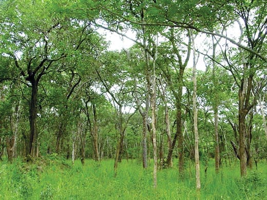
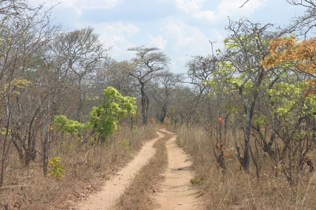
Named for the miombo trees found in the region, these biomes (geographical areas defined by their local species and climate) are vital ecosystems that directly support many millions of livelihoods, regulate climate and water resources, provide habitats for plants and animals, and hold cultural and spiritual significance.
Over the past 40 years, deforestation has reduced these woodlands from 2.7 to 1.9 million square kilometres, making accurate ongoing monitoring essential. The deforested sites span an area three times greater than the land area of the United Kingdom.
In 2022, the researchers, working with local Mozambican partners, collected 450 billion 3D measurements across more than 8 million trees covering 500 square kilometres of miombo woodlands in and around Gilé National Park, Mozambique – an area eight times the size of Manhattan.
The team used ground, drone- and helicopter-based laser scanning to capture this data across intact woodlands, secondary woodlands in various states of degradation, and clear land.
These measurements were used to generate estimates of aboveground biomass (the weight of trees above ground) that showed the carbon stored in these woodlands was 1.5 to 2.2 times more than that predicted by conventional methods. This was partly due to the reliance of traditional techniques or methods, known as allometrics, that link simple-to-measure tree variables such as stem diameter and tree height to carbon, and have been found to underestimate the biomass of large trees.
This new research marks the first time region-scale estimates of forest carbon have been calculated independent of allometry, using multi-scale lidar data.
Co-author, Professor Mat Disney (UCL Geography) said: “Using these 3D laser scanning measurements, we’re able to significantly improve the accuracy of our estimates of the biomass and carbon stored in these critical and dynamic miombo woodlands. The fact that these new results are so much greater than previous estimates demonstrates that these ecosystems are even more important than we thought and highlights why we need to protect them, now more than ever.”
Applying the results of this study across all of Africa’s miombo woodlands, suggests that conventional measurement techniques potentially underestimate their carbon stocks by an amount of carbon nearly equivalent to the total atmospheric increase in a single year.
Extrapolating the results across all miombo woodlands, the study estimated they potentially store 13.6 billion tonnes of equivalent carbon dioxide (Gt CO2e) more carbon in their aboveground biomass than currently expected, though this extrapolation requires additional data for confirmation.
The results of the study have important implications for the understanding of the role that miombo woodlands can play in efforts to tackle climate change. Their destruction could release significantly more carbon than thought, and governments, business and finance need to do much more to prioritise protecting and restoring these often forgotten forests as a crucial climate change mitigation pathway.
The unprecedented accuracy and reliability of the 3D measurements collected in this new study show it is possible to obtain the kind of data necessary to provide confidence and certainty in the value of carbon credits and scale finance to nature-based solutions, especially those involving forests. It also suggests the value of investing in, or financing, activities such as forest restoration or avoiding deforestation is even greater than previously thought.
Co-author Dr Laura Duncanson, of the University of Maryland and NASA GEDI science team, said: “Mapping biomass from space is always limited by the availability of high-quality calibration and validation data. This research demonstrates the state of the art in multi-scale lidar methods for linking trees to satellites. We are now working to integrate these data into our NASA GEDI biomass products, and fully expect they will lead to improvements in mission estimates over miombo woodlands in Mozambique, and beyond.”
The data collection and analysis were led by Sylvera, a data provider that combines cutting-edge technology with leading carbon measurement methods to ensure funding is going to the projects, companies, and countries having maximum climate impact to get the world on track for net zero.
Allister Furey, CEO and Co-founder of Sylvera, said, “Ultimately, fighting climate change is a finance issue. We need more money flowing to the known solutions, predominantly our natural carbon sinks. Yet, many investors simply don’t understand these types of investments, or are put off by lack of certain measurements and so avoid them.”
“To help increase investor confidence, Sylvera has pioneered a new way to measure carbon stored in nature and scaling those measurements with machine learning models so that we can know the true impact of restoring it and the harmful effects of damaging it,” he added.
“Our team’s findings across miombo woodlands is a true testament to the power of how technology can help us better understand nature to expedite investment and make real net zero progress, because we’re simply running out of time,” Furey said.
The work was led by researchers at Sylvera, in conjunction with researchers from UCL, NERC National Centre for Earth Observation (NCEO), University of Maryland, University of Edinburgh, Mozambique, and the University of Leicester, and in collaboration with and co-financing from the National Fund for Sustainable Development (Mozambique) and The World Bank Group.
More information: Demol, M., Aguilar-Amuchastegui, N., Bernotaite, G. et al., ‘Multi-scale lidar measurements suggest miombo woodlands contain substantially more carbon than thought’, Communications Earth & Environment (5, 366; 2024); DOI: 10.1038/s43247-024-01448-x. UCL Press Release / Material. Featured image credit: Dr. Thomas Wagner | CC BY-SA 3.0


